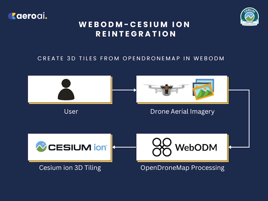
Create 3D Tiles from OpenDroneMap in WebODM
In April 2024, AERO AI, a Cesium Certified Developer, was awarded a Cesium Ecosystem Grant to reintegrate Cesium ion and WebODM, a free and open source drone imagery processing platform from OpenDroneMap.
The OpenDroneMap community can now tile aerial data as 3D Tiles directly from the WebODM dashboard.
AERO AI’s Cesium Ecosystem Grant supports the WebODM Reintegration Project, focusing on the WebODM Cesium plugin. The plugin enables users from AEC, environmental conservation, geospatial analysis, and beyond to benefit from the ability to integrate, process, analyze, and visualize aerial data and 3D geospatial information.
Workflow for a user to process drone imagery in OpenDroneMap’s WebODM and upload to Cesium ion. Courtesy AERO AI.
Developed by OpenDroneMap, WebODM is open source software for drone image processing that is widely used by drone pilots, organizations, and academic institutions. It allows users to generate maps, point clouds, DEMs, and 3D models from aerial imagery. With the Cesium ion plugin, users can effortlessly upload this data to Cesium ion, where it is transformed into 3D Tiles for diverse applications. These include creating scalable, high-resolution immersive experiences and digital twins of buildings and urban environments. Users can also produce maps for disaster recovery, urban planning, wildlife management, and environmental monitoring, providing critical insights into terrain changes over time and improving decision-making for projects that require precise spatial analysis.
With the Cesium ion plugin, WebODM users can effortlessly upload their data to Cesium ion, where it is transformed into 3D Tiles for diverse applications. Courtesy AERO AI.
AERO AI rebuilt the Cesium plugin from the ground up, enabling the seamless integration of georeferenced ortho maps, point clouds, and 3D models generated in WebODM with Cesium ion. We removed the deprecated react-bootstrap dependency and implemented several API updates to improve overall functionality. We also resolved issues with dropdown buttons, refined styling with a cursor change, and refactored the modal usage. Our team fixed the file upload functionality in the UploadDialog and addressed text input issues. Plus we made adjustments to the task dialog, added logic to generate zip files for textured models, and updated the manifest plugin version while removing outdated dependencies. The full list of updates is here. Reach out to AERO AI with questions.
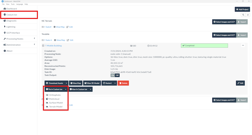
Options to upload and tile orthophotos, point clouds, surface models, and terrain models generated in WebODM to Cesium ion using the Cesium ion plugin for WebODM.
AERO AI developed the Simulated Environment for Geospatial Assets (SiEGA) platform, which integrates a variety of 3D technologies within an advanced physics engine. SiEGA supports streaming 3D Tiles and allows for the seamless import of WebODM assets, tiled through Cesium ion for high-resolution geospatial visualization. It is among the 3D creation engines that support streaming 3D Tiles.
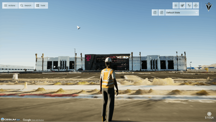
WebODM-generated 3D model tiled as 3D Tiles by Cesium ion and streamed to AERO AI’s platform, SiEGA. Courtesy AERO AI.
The WebODM-Cesium ion integration is straightforward. Follow the new tutorial to try it out.